High-resolution drone images are a growing source of data for mapping, surveying, infrastructure inspection, environmental monitoring, and other fields of geospatial information collection. However, obtaining the images is only one part of the story. The actual challenge is to process hundreds, if not thousands, of images of the area taken from the UAV into useful geospatial data.
The open-source projects OpenDroneMap (ODM) and QGIS offer a solution that allows one to process UAV imagery and build maps, perform analysis on them, and visualize the results without having to rely on proprietary GIS software. ODM can process overlapping images into orthophotos, point clouds, and even textured 3D meshes, which can then be further analyzed using QGIS.
Camera Features That Matter for UAV Mapping
When collecting high-resolution imagery, camera capabilities can directly influence source data quality. Some useful features to consider include:
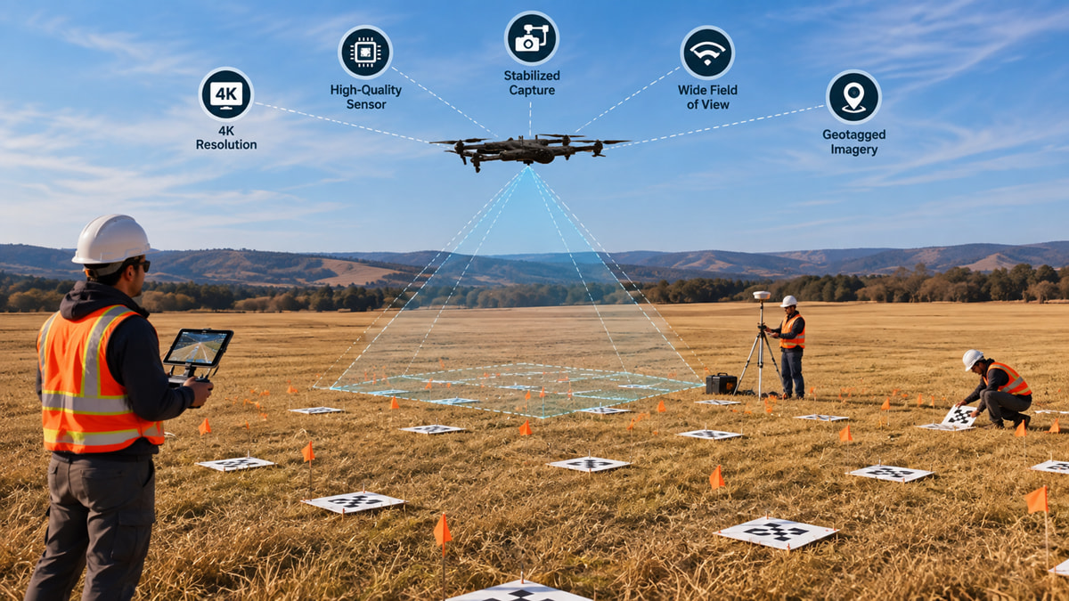
Capturing detailed aerial imagery with a drone camera 4K can provide high-resolution source data for photogrammetry workflows, which can then be processed with tools such as OpenDroneMap and analyzed in QGIS.
-
4K Image and Video Resolution: Capturing at high resolution ensures high detail for visual information that can be leveraged for inspection, mapping, change detection, and other applications of a survey area.
-
Stable and Clear Image Quality: A good sensor can enhance image fidelity, resulting in more stable imagery for processing.
-
Stabilized Image Acquisition: Camera stabilization can be used to mitigate the effects of unintended motions and blurring while flying UAVs to acquire imagery in future flight tracks.
-
Wide Field of View: A comfortable field of view to be able to capture more ground area, but altitude of flight, lens attributes, and needed ground sampling distance should be included.
-
Geotagging of Images: Having location information recorded for an image can aid photogrammetry and allow the organization of imagery in a geographic workflow.
Processing High-Resolution Imagery with OpenDroneMap
A common workflow involves planned UAV flights of overlapping images, which can later be processed with OpenDroneMap.
ODM applies photogrammetric methods to extract common points from overlapping images and then recombine the photographs to produce the area surveyed. The final products of this may be a:orthophoto, point cloud, digital surface model (DSM), digital terrain model (DTM), and a 3D model.
Q4.1 There is often substantial processing requirement associated with higher-resolution imagery. Large datasets can require a great deal of RAM, storage and time to process. It can therefore be more practical to think about the actual mapping objective, the desired ground resolution, flight height, overlap and available computing power rather than just using the highest possible resolution imagery.
Bringing the Results into QGIS
The outputs obtained as a result of processing, including GeoTIFF orthophotos and elevation models, may be imported into QGIS and undergo further processing. Depending on the tasks, a user may use existing vector layers, conduct a comparison of surveys taken at different points in time, receive information about elevation, create contours, etc.
When dealing with very large raster data sets, proper organization and optimization of the rasters are important. Tiling, compression, overviews, and Cloud Optimized GeoTIFFs (COGs) may help improve the handling of such big UAV-derived raster data sets.
We are interested in using high-resolution imagery derived with UAVs in combination with open-source geospatial software. One of the topics we would like to explore more in depth is the optimal combination of image quality, processing needs and GIS outputs that are obtainable with the help of open-source geospatial software.
For everyone who uses UAV imagery in OpenDroneMap and QGIS: What do you consider the most effective practices for handling large, high-resolution datasets? Do you optimize or tile imagery before performing further processing in QGIS?