Gabriel,
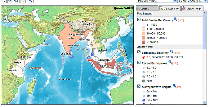
Here's a mapserver example:
http://mapsherpa.com/tsunami/
(see attached picture)
I'm not sure if the legend is auto-generated or if its hand-made.
I think we could label some of the graphics - for example from the
<Title> or <Abstract> from the rule.
Its a really really really difficult problem!!
dave
----------------------------------------------------------
This mail sent through IMP: https://webmail.limegroup.com/
(attachments)
On Monday 11 July 2005 20:23, dblasby@anonymised.com wrote:
Gabriel,
Here's a mapserver example:
http://mapsherpa.com/tsunami/
(see attached picture)
I'm not sure if the legend is auto-generated or if its hand-made.
looks hand-made (<img src="/ms_tmp/1121108403_16_0_15_15.png"...) on all
graphics, layer and range names are html text too, etc.
I think we could label some of the graphics - for example from the
<Title> or <Abstract> from the rule.
indeed, it could be done. ArcIMS does it, returning a graphic with layer,
range names or rule names, altogether.
Most today's clients should be able of putting the layer name by theirselves,
though if the legend graphic comes with the range/rule name at a side of each
style sample, it will be far easier than having to inspect the SLD, if
available, to figure out which rules apply to the current scale.
Its a really really really difficult problem!!
really?
dave
----------------------------------------------------------
This mail sent through IMP: https://webmail.limegroup.com/
--
Gabriel Roldán <groldan@anonymised.com>
Axios Engineering <http://www.axios.es>
CR/Basurtu-Kastrexana 70, Mod. 14
48002 - Bilbao, Spain
te. (+34) 94 441 63 84
fax (+34) 94 441 64 90
