Dear geoserver community,
we are a team from a scientific institute in Leipzig/Germany and work with geospatial data, especially with netCDFs files.
We would like to create web services from netCDFs files with the geoserver netcdf plugin, unfortunately the plugin cannot read our netCDFs structure.
To get an idea of the structure of the netCDFs you can check this page: https://git.idiv.de/lq39quba/ebv_data_standard
Two datasets that we propose for ‘taking a look’ are the following:
- https://portal.geobon.org/data/upload/1/public/martins_comcom_id1_20220208_v1.nc
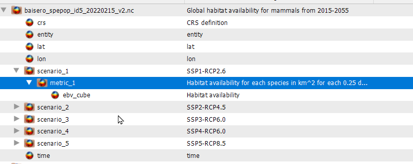
- https://portal.geobon.org/data/upload/5/public/baisero_spepop_id5_20220215_v2.nc
We are using GeoServer 2.20.1 with the netCDF plugin (geoserver-2.20.1-netcdf-plugin.zip) on a Tomcat 9 locally on a Mac (localhost:8080).
We have followed the tutorial: https://geoserver.geo-solutions.it/multidim/multidim/netcdf/netcdf_config.html#netcdf
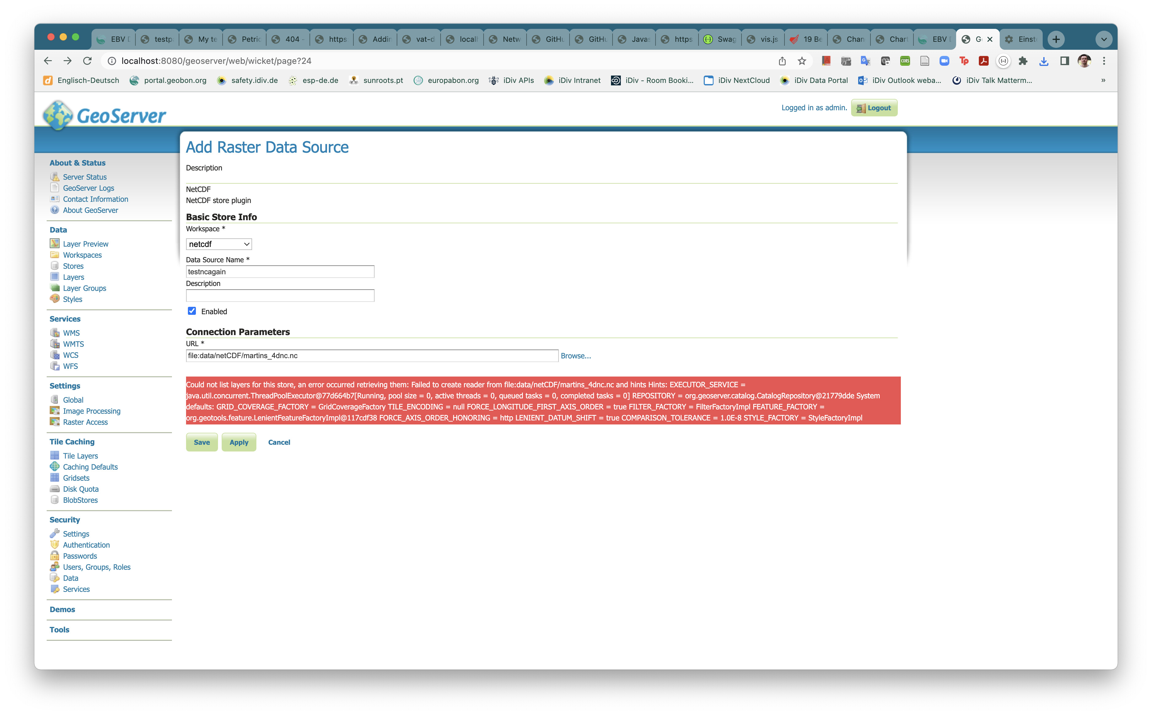
We are getting always the error: “Could not list layers for this store, an error occurred retrieving them: Failed to create reader from file” (please see screenshot attached). It seems geoserver has problems to handle the 4th dimension. Complete log file here: geoserver.log
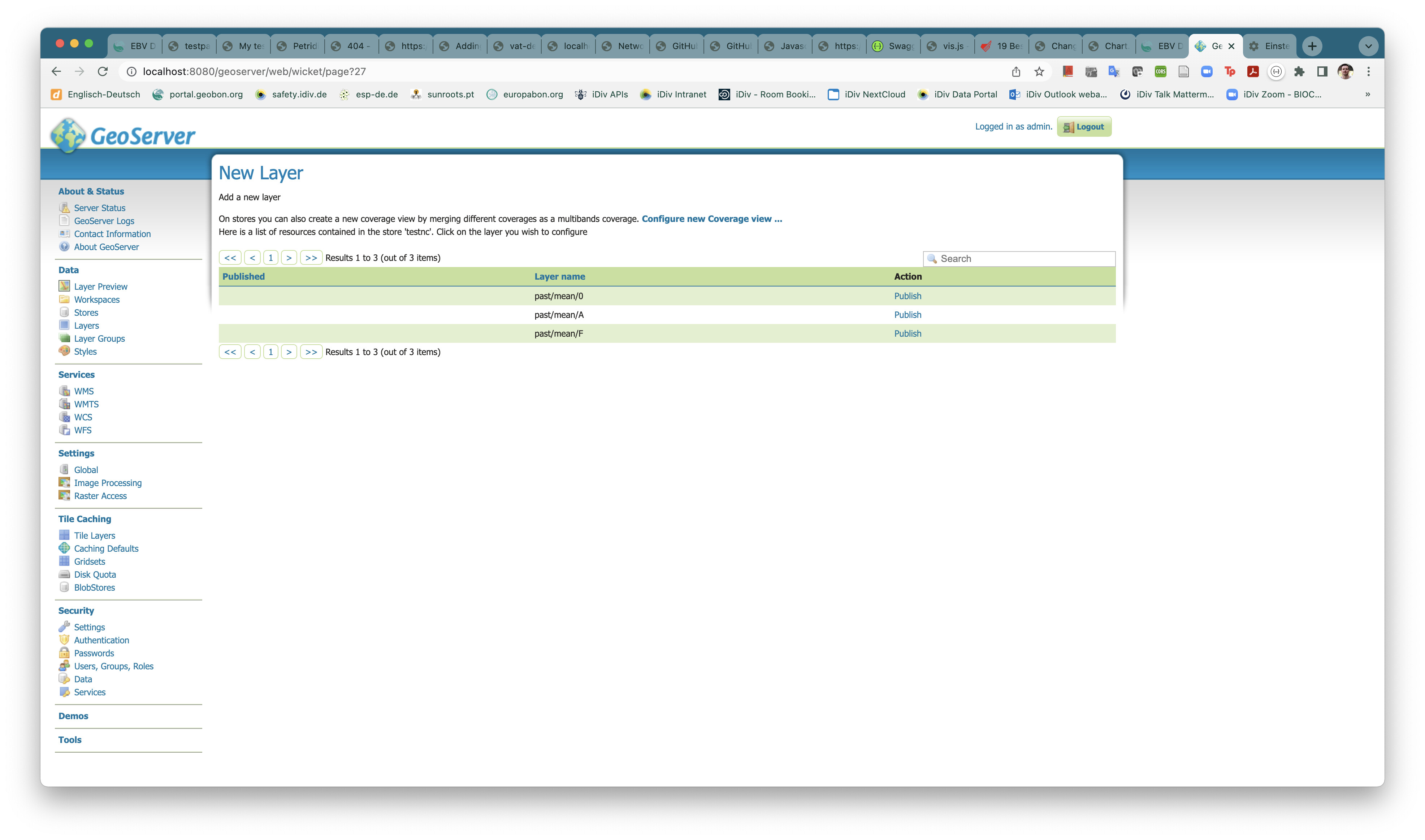
We have tried the same with a netCDF structure in 3d and it works like a charm - geoserver could list the layers (see screenshot attached).
Could we get a contact to the developer of the netCDF Plugin? Or can you help us directly?
Any help is much appreciated!
Thanks in advance.
Best regards,
Christian Langer
Christian Langer
Web-GIS Programmer / Web-GIS Programmierer
German Centre for Integrative Biodiversity Research (iDiv) Halle-Jena-Leipzig
Phone +49 341 9733141
Office B.02.11
Email christian.langer@…11648…
Website www.idiv.de/christian-langer
Affiliations
Martin Luther University Halle-Wittenberg
German Centre for Integrative Biodiversity Research (iDiv) Halle-Jena-Leipzig
Puschstraße 4
04103 Leipzig
Germany
iDiv is a research centre of the DFG – Deutsche Forschungsgemeinschaft
iDiv ist eine zentrale Einrichtung der Universität Leipzig im Sinne des § 92 Abs. 1 SächsHSFG und wird zusammen mit der Martin-Luther-Universität Halle-Wittenberg und der Friedrich-Schiller-Universität Jena betrieben sowie in Kooperation mit dem Helmholtz-Zentrum für Umweltforschung GmbH – UFZ. Beteiligte Kooperationspartner sind die folgenden außeruniversitären Forschungseinrichtungen: das Helmholtz-Zentrum für Umweltforschung GmbH - UFZ, das Max-Planck-Institut für Biogeochemie (MPI BGC), das Max-Planck-Institut für chemische Ökologie (MPI CE), das Max-Planck-Institut für evolutionäre Anthropologie (MPI EVA), das Leibniz-Institut Deutsche Sammlung von Mikroorganismen und Zellkulturen (DSMZ), das Leibniz-Institut für Pflanzenbiochemie (IPB), das Leibniz-Institut für Pflanzengenetik und Kulturpflanzenforschung (IPK) und das Leibniz-Institut Senckenberg Museum für Naturkunde Görlitz (SMNG). USt-IdNr. DE 141510383