Hi guys,
We am working for a mapping project for UNICEF and we are planning to use Geoserver for displaying info on maps using shape files. The idea is same as the Google map overlay example which comes with Geoserver.
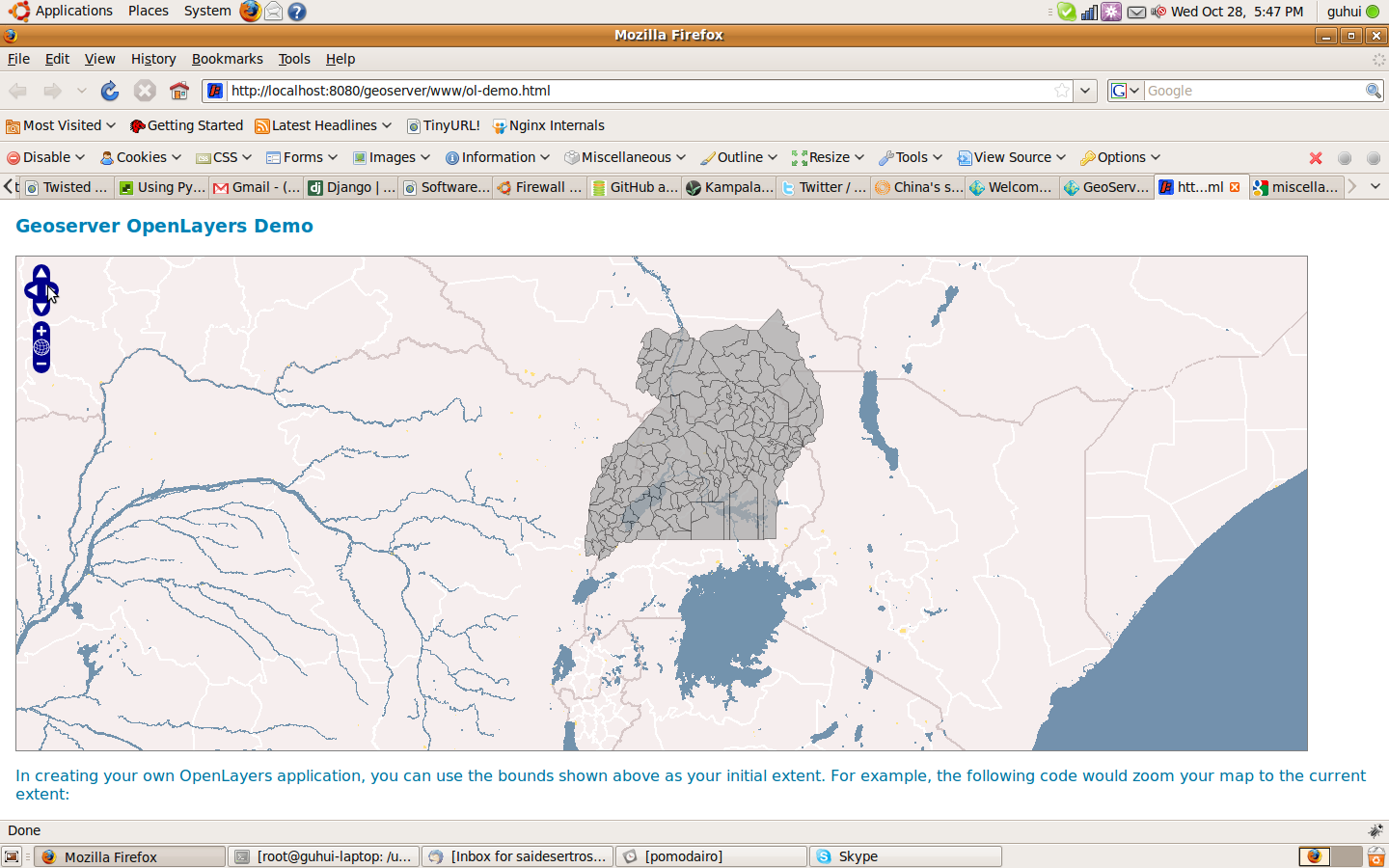
I have the shape files of Uganda. And I am using them to show the administrative districts on top of Google maps. The overlay seems to be showing up on the map but it seems to be off the mark.
I have attached a screen shot of the map which uses Metacarta as the base map layer.
Following are the featuretype editor details
SRS - 32636
SRS Wkt - PROJCS[“WGS 84 / UTM zone 36N”, GEOGCS[“WGS 84”, DATUM[“World Geodetic System 1984”, SPHEROID[“WGS 84”, 6378137.0, 298.257223563, AUTHORITY[“EPSG”,“7030”]], AUTHORITY[“EPSG”,“6326”]], PRIMEM[“Greenwich”, 0.0, AUTHORITY[“EPSG”,“8901”]], UNIT[“degree”, 0.017453292519943295], AXIS[“Geodetic longitude”, EAST], AXIS[“Geodetic latitude”, NORTH], AUTHORITY[“EPSG”,“4326”]], PROJECTION[“Transverse Mercator”, AUTHORITY[“EPSG”,“9807”]], PARAMETER[“central_meridian”, 33.0], PARAMETER[“latitude_of_origin”, 0.0], PARAMETER[“scale_factor”, 0.9996], PARAMETER[“false_easting”, 500000.0], PARAMETER[“false_northing”, 0.0], UNIT[“m”, 1.0], AXIS[“Easting”, EAST], AXIS[“Northing”, NORTH], AUTHORITY[“EPSG”,“32636”]]
Min Long - 29.554490551812258
Min Lat - 0.32791450455053306
Max Long - 35.01046421854283
Max Lat - 6.04398958609871
I have uploaded the shape file for download here - http://miscellaneous-downloads.googlecode.com/files/uganda_county2006.zip
Any help on how to solve this problem or insight will be highly appreciated. Please let me know if you need more info.
Thank you
–
Regards,
Sai
http://developer-in-test.blogspot.com
http://code.google.com/p/chrome-watir
http://twitter.com/sai_venkat