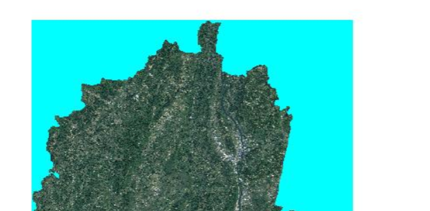
I publish a raster data with GeoServer, but a strange thing happened. If I publish the data with GeoTIFF, it is correct, like this:
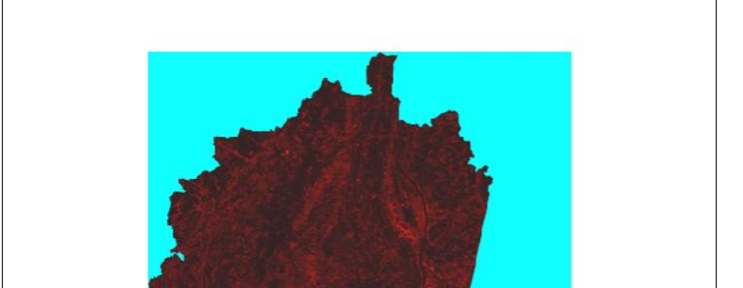
But when I transform it as pyramid image and publish the data with ImagePyramid.The color is not correct. It become read like this:
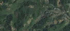
When I zoom in the map, it became correct, like the GeoTIFF map.
I do not know what happened.I need help.
Thank you for your kind cooperation.