Hi, these url's are working?
gser.reciem.org:8080/geoserver/reciem/ows?service=WFS&version=1.0.0&request=GetFeature&typeName=reciem:cs_volcano_timeslab&outputFormat=application/json&viewparams=use:'regular';hour:'02'
{"type":"FeatureCollection","totalFeatures":539....
gser.reciem.org:8080/geoserver/reciem/ows?service=WFS&version=1.0.0&request=GetFeature&typeName=reciem:cs_volcano_timeslab&outputFormat=application/json&viewparams=use:'regular';hour:'03'
{"type":"FeatureCollection","totalFeatures":546,"features":...
note the different number of features.
I had to put the values in quotes, not sure if that is always mandatory
Regards,
Richard Duivenvoorde
On 15-10-17 23:19, Santiago Núñez Corrales wrote:
Good afternoon,
I am new to GeoServer, and after setting up an SQL view, sending data to
the parameters produces no effect.
My setting is as follows:
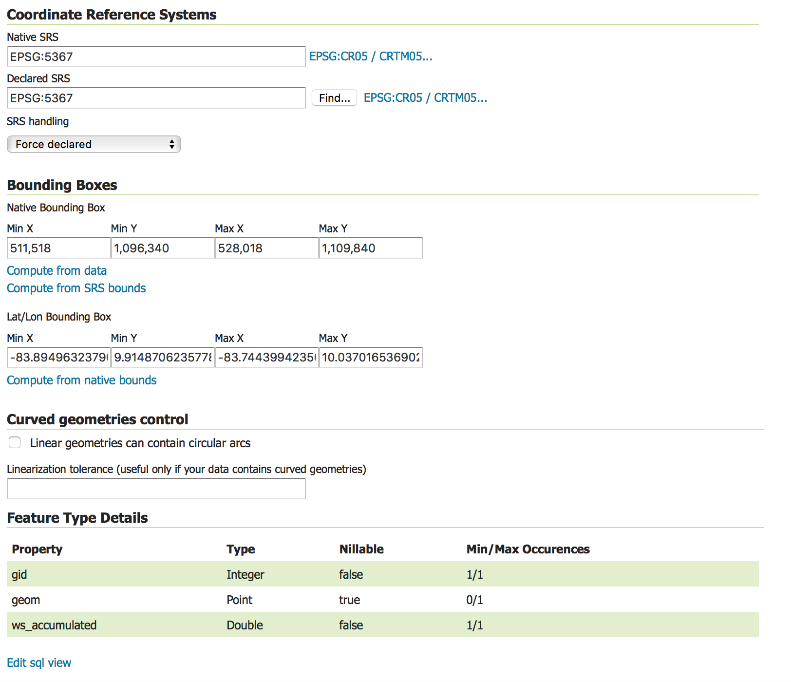
1. A PostGIS database with the following table definition (CRTM05,
EPSG:5367). The database contains only Point objects with a series of
attributes.
2. An installation of GeoServer ver 2.11.2.
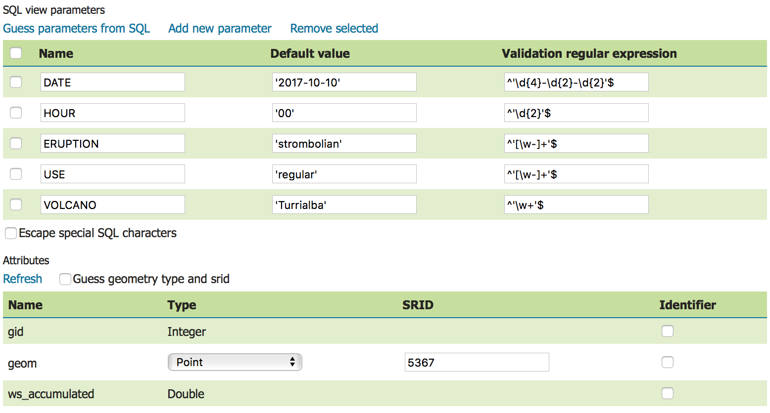
3. An SQL view as follows:
*
*
*SQL*
SELECT gid, geom, ws_accumulated
FROM ws_cr_volcanoes_ashfall
WHERE
ws_volcano=%VOLCANO%
AND ws_eruption=%ERUPTION%
AND ws_use=%USE%
AND ws_date=%DATE%
AND ws_hour=%HOUR%
- With the following parametrization and validation:
With the following attribute settings:
My service is setup at:
http://gser.reciem.org:8080/geoserver/reciem/ows?service=WFS&version=1.0.0&request=GetFeature&typeName=reciem:cs_volcano_timeslab&outputFormat=application%2Fjson
<http://gser.reciem.org:8080/geoserver/reciem/ows?service=WFS&version=1.0.0&request=GetFeature&typeName=reciem:cs_volcano_timeslab&outputFormat=application/json>
What may my mistake be?
Kind regards,
--
Santiago Núñez-Corrales
Graduate student, Informatics Ph.D. Program
University of Illinois at Urbana-Champaign
+1 (217) 979-9575
------------------------------------------------------------------------------
Check out the vibrant tech community on one of the world's most
engaging tech sites, Slashdot.org! http://sdm.link/slashdot
_______________________________________________
Geoserver-users mailing list
Please make sure you read the following two resources before posting to this list:
- Earning your support instead of buying it, but Ian Turton: http://www.ianturton.com/talks/foss4g.html#/
- The GeoServer user list posting guidelines: http://geoserver.org/comm/userlist-guidelines.html
Geoserver-users@lists.sourceforge.net
https://lists.sourceforge.net/lists/listinfo/geoserver-users