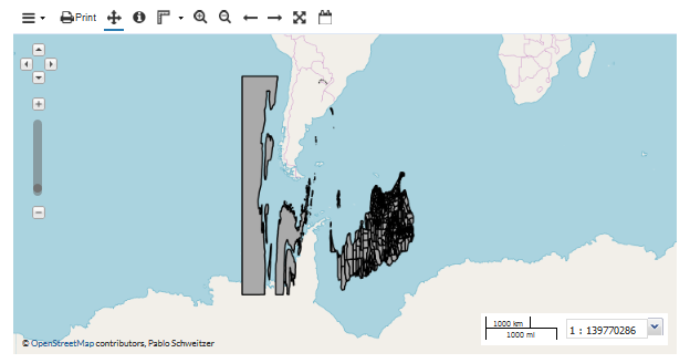
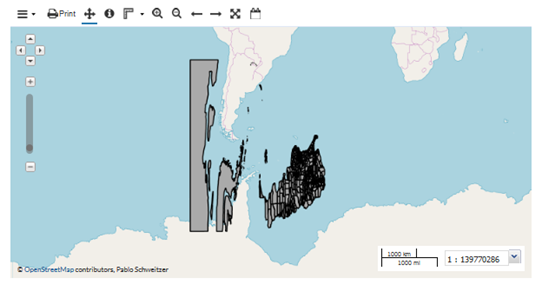
Hello
I’m incorporating a layer in my geoserver from this service https://geoservicios.indec.gov.ar/geoserver/ows? but I have problems with the axes. How is it solved?

Thanks!
Pablo
Hello
I’m incorporating a layer in my geoserver from this service https://geoservicios.indec.gov.ar/geoserver/ows? but I have problems with the axes. How is it solved?

Thanks!
Pablo
Please give us a hint!
what projection is your map in? your data in? how did you define the axis order? which version of which standard did you use?
Without that information we are just guessing
Ian

Ian Turton
Hi
Te wfs is https://geoservicios.indec.gov.ar/geoserver/ows?service=wfs&version=2.0.0&request=GetCapabilities
Thanks
Pablo
El jue., 4 abr. 2019 a las 17:18, Phil Scadden (<P.Scadden@anonymised.com>) escribió:
Got an example WFS call that you are making? And most importantly the version bit.
From: Pablo Schweitzer <pablosarg@anonymised.com>
Sent: Friday, 5 April 2019 05:07
To: geoserver-users@lists.sourceforge.net
Subject: [Geoserver-users] Problems with the axes using wfsHello
I’m incorporating a layer in my geoserver from this service https://geoservicios.indec.gov.ar/geoserver/ows? but I have problems with the axes. How is it solved?
Thanks!
Pablo
Notice: This email and any attachments are confidential and may not be used, published or redistributed without the prior written consent of the Institute of Geological and Nuclear Sciences Limited (GNS Science). If received in error please destroy and immediately notify GNS Science. Do not copy or disclose the contents.
That is just the getcaps call (returns the capabilities of the wfs server). What would be good to see is the WFS call that fetches the data.

Hi
Te wfs is https://geoservicios.indec.gov.ar/geoserver/ows?service=wfs&version=2.0.0&request=GetCapabilities
Thanks
Pablo
El jue., 4 abr. 2019 a las 17:18, Phil Scadden (<P.Scadden@…1389…>) escribió:
Got an example WFS call that you are making? And most importantly the version bit.
From: Pablo Schweitzer <pablosarg@…84…>
Sent: Friday, 5 April 2019 05:07
To: geoserver-users@lists.sourceforge.net
Subject: [Geoserver-users] Problems with the axes using wfsHello
I’m incorporating a layer in my geoserver from this service https://geoservicios.indec.gov.ar/geoserver/ows? but I have problems with the axes. How is it solved?
Thanks!
Pablo
Notice: This email and any attachments are confidential and may not be used, published or redistributed without the prior written consent of the Institute of Geological and Nuclear Sciences Limited (GNS Science). If received in error please destroy and immediately notify GNS Science. Do not copy or disclose the contents.