Hello all.
Excuse me if this topic has been dealt with before, but I couldn’t find
any relevant information on this.
I have a case where I want to display an external graphic on top of a
line geometry. The grahpic is used to indicate certain properties of the
line.
Anyways: I quickly found out that, for labels (i.e. textSymbolizers)
this was easy, make a rule with both a LineSymbolizer and a
TextSymbolizers. The label seems to be drawn on the centerpoint of the
visible part of the line (and, most important: on top of the line).
Following this line of thought i tried using the same approach with a
PointSymbolizer (in this case with a Graphic, but the plan is an
ExternalGraphic).
In this case however, with a LineSymbolizer and a PointSymbolizer in the
same rule, the graphic is drawn at what seems to be the center if the
line is converted to a polygon: i.e. for curved lines not on top of the
line, but in the vinciity.
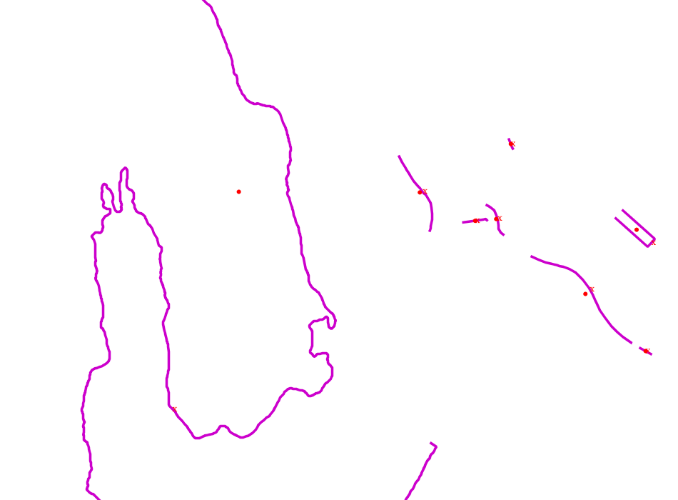
See the attached image for how the PointSymolizer and TextSymbolizer
places its content relative to the line (the x is a TextSymbolizerm the
dot is a PointSymbolizer).
The SLD I’m currently using is atteched beneath.
So, the question is if it is possible to use a PointSymbolizer to draw
it’s content in the same position (relative to a line) as the
TextSymbolizer does. The easy solution would of course be to use a
TextSymbolizer instead, but we kinda require an icon on the, which calls
for a PointSymbolizer.
And, more out of interest: another question is wether the difference
between Points and Text relative to lines are on purpose, or just
something that noone has thought of?
best regards
Atle Sveen
Geomatikk IKT
Message and incident Lines
Message and incident Lines
–
Atle Frenvik Sveen
Utvikler
Geomatikk IKT AS
tlf: 45 27 86 89
atle.frenvik.sveen@…2699…