Hello All,
We just upgraded our GeoServer from version 2.1.4 to version 2.4.2 including Oracle plugin. The GeoServer data directory is re-used when upgrading.
We have not installed GeoTools v10.2. The upgrading seems OK but we do have a problem with one raster layer.
The raster layer is called “RASTER_10K” with its style configuration like
2501
20000
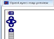
When opening Layer Preview > OpenLayers for the “RASTER_10K” layer in the GeoServer 2.4.2, it displays a map at 1:2861 only. It displays a red X box behind the menu button without map at 1:11K and 1:5722 like the attached png file.
The “RASTER_10K” layer is a member of layer groups with other layers like “RASTER_50K” and “RASTER_250K”; those “RASTER_50K” and “RASTER_250K” layers do not have problem.
We could display maps at 1:11K, 1:5722 and 1:2861 scales on the GeoServer v2.1.4.
When I reproduced the preview the layer, the GeoServer v2.4.2 log file contains some errors like
2013-12-05 20:51:49,109 INFO [geoserver.wms] -
Request: getServiceInfo
2013-12-05 20:51:49,124 ERROR [geoserver.ows] -
org.geoserver.platform.ServiceException: Error rendering coverage on the fast path
at org.geoserver.wms.map.RenderedImageMapOutputFormat.produceMap(RenderedImageMapOutputFormat.java:331)
at org.geoserver.wms.map.RenderedImageMapOutputFormat.produceMap(RenderedImageMapOutputFormat.java:251)
…
2013-12-05 20:51:54,734 ERROR [geotools.map] - Call MapContent dispose() to prevent memory leaks
2013-12-05 20:51:54,734 ERROR [geotools.map] - Call MapContent dispose() to prevent memory leaks
2013-12-05 20:51:58,906 INFO [geoserver.wms] -
Request: getServiceInfo
2013-12-05 20:51:58,921 ERROR [geoserver.ows] -
org.geoserver.platform.ServiceException: Error rendering coverage on the fast path
at org.geoserver.wms.map.RenderedImageMapOutputFormat.produceMap(RenderedImageMapOutputFormat.java:331)
at org.geoserver.wms.map.RenderedImageMapOutputFormat.produceMap(RenderedImageMapOutputFormat.java:251)
at org.geoserver.wms.map.RenderedImageMapOutputFormat.produceMap(RenderedImageMapOutputFormat.java:123)
Could you please help?
How to fix this problem? Do I need install GeoTools v10.2? Do I need install anything else?
The GeoServer runs on Windows Server 2008 R2 with Jetty web server; Java version 1.6.)_32 is used. We have also installed JAI 1.1.3 with GoeServer v2.1.4.
Thanks in advance.
Shang
PS: when we tested earlier, there are other errors with GeoServer 2.4.2 like:
2013-12-05 12:50:43,904 INFO [geoserver.wms] -
Request: getServiceInfo
2013-12-05 12:50:43,904 WARN [geotools.rendering] - Unable to create this mosaic
org.geotools.data.DataSourceException: Unable to create this mosaic
at org.geotools.gce.imagemosaic.RasterLayerResponse.prepareResponse(RasterLayerResponse.java:1282)
at org.geotools.gce.imagemosaic.RasterLayerResponse.processRequest(RasterLayerResponse.java:1125)
at org.geotools.gce.imagemosaic.RasterLayerResponse.createResponse(RasterLayerResponse.java:1091)