Hi All,
I have implemented geoserver heatmap from this tutorial https://docs.geoserver.org/latest/en/user/styling/sld/extensions/rendering-transform.html#heatmap-generation , using android demo from this example app https://github.com/shalperin/android-wms
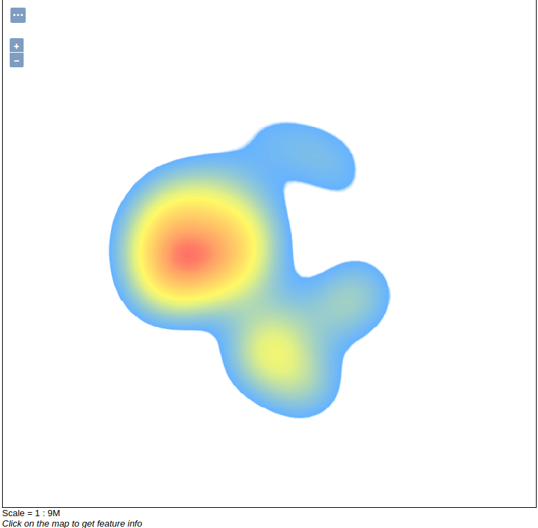
In the layer preview in geoserver (openlayers) the output shows correctly as below

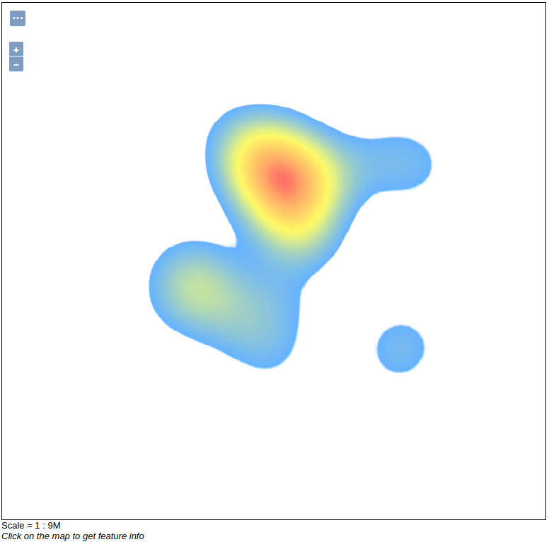
However on android mobile app the tiles don’t align as shown in the image below

What could be the problem?
Attached is the source of the layer preview from geoserver, WMSTileProvider and TuileProviderFactory
Regards,
Erick
application_openlayers.html (43.3 KB)
TileProviderFactory.java (1.52 KB)
WMSTileProvider.java (1.71 KB)
Hi All,
I have implemented geoserver heatmap from this tutorial https://docs.geoserver.org/latest/en/user/styling/sld/extensions/rendering-transform.html#heatmap-generation , using android demo from this example app https://github.com/shalperin/android-wms
In the layer preview in geoserver (openlayers) the output shows correctly as below

However on android mobile app the tiles don’t align as shown in the image below

What could be the problem?
Attached is the source of the layer preview from geoserver, WMSTileProvider and TuileProviderFactory
Regards,
Erick
application_openlayers.html (43.3 KB)
TileProviderFactory.java (1.52 KB)
WMSTileProvider.java (1.71 KB)
Erick,
try replacing x by y or try putting -y in your url pattern.
Good luck.
--
Sent from: http://osgeo-org.1560.x6.nabble.com/GeoServer-User-f3786390.html
It isn’t possible to do this - when you make a tiled map each tile is independently created - see https://gis.stackexchange.com/questions/245379/adjust-geoserver-geotools-heatmap-code-to-show-it-as-tiled-wms/245959#245959 for a longer answer.
Ian
Ian,
you are right. From the images I thought the tiles were already created.
The only way would be to generate bigger WMS image and generate tiles from
them (cookie-cutter). I guess it would be possible with the right
meta-tiling parameters ...
--
Sent from: http://osgeo-org.1560.x6.nabble.com/GeoServer-User-f3786390.html
Hi Olyster,
Replacing x by y or making y value to be -y, makes the tile not visible in the android client.
Erick
On Fri, Apr 17, 2020 at 5:37 PM Olyster <gagnon_olivier@anonymised.com.5777…> wrote:
Erick,
try replacing x by y or try putting -y in your url pattern.
Good luck.
–
Sent from: http://osgeo-org.1560.x6.nabble.com/GeoServer-User-f3786390.html
Geoserver-users mailing list
Please make sure you read the following two resources before posting to this list:
If you want to request a feature or an improvement, also see this: https://github.com/geoserver/geoserver/wiki/Successfully-requesting-and-integrating-new-features-and-improvements-in-GeoServer
Geoserver-users@lists.sourceforge.net
https://lists.sourceforge.net/lists/listinfo/geoserver-users
Hi Ian,
The strange thing is that openlayer geoserver layer preview client doesn’t misalign the tiles, check below:

It’s only android tile provider that misalign the tiles, see below.

This might be, either due to tile size used by openlayers geoserver layer preview client or tile origin that android tile provider uses, I will try and play around with tile resize and origin and see whether the misalignment will be resolved.
Erick
On Fri, Apr 17, 2020 at 5:17 PM Ian Turton <ijturton@anonymised.com> wrote:
It isn’t possible to do this - when you make a tiled map each tile is independently created - see https://gis.stackexchange.com/questions/245379/adjust-geoserver-geotools-heatmap-code-to-show-it-as-tiled-wms/245959#245959 for a longer answer.
Ian
It’s more likely to be because the preview doesn’t have tiling turned on by default - this is not an alignment issue it is the fact that each tile is calculated separately so you get edge effects on each tile (and the maximum will be different too so the colors will be off)
Ian
···
Ian Turton


