Hi Pedro,
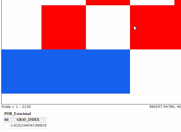
by the looks of the image, I see you’re issuing a GetFeatureInfo with a 50
to 100 times oversampling factor
(1 pixel is represented as a 50x50 to 100x100 pixels), small numerical
issues are inflated significantly in that scenario.
I’m not aware of a magic “make it work” flag, code analysis and changes
seem the best way to approach this.
See this guide to get it done:
Regards,
Andrea Aime
==
GeoServer Professional Services from the experts!
Ing. Andrea Aime
@geowolf
Technical Lead
GeoSolutions Group
phone: +39 0584 962313
fax: +39 0584 1660272
mob: +39 339 8844549
http://twitter.com/geosolutions_it
Con riferimento alla normativa sul trattamento dei dati personali (Reg. UE
2016/679 - Regolamento generale sulla protezione dei dati “GDPR”), si
precisa che ogni circostanza inerente alla presente email (il suo
contenuto, gli eventuali allegati, etc.) è un dato la cui conoscenza è
riservata al/i solo/i destinatario/i indicati dallo scrivente. Se il
messaggio Le è giunto per errore, è tenuta/o a cancellarlo, ogni altra
operazione è illecita. Le sarei comunque grato se potesse darmene notizia.
This email is intended only for the person or entity to which it is
addressed and may contain information that is privileged, confidential or
otherwise protected from disclosure. We remind that - as provided by
European Regulation 2016/679 “GDPR” - copying, dissemination or use of this
e-mail or the information herein by anyone other than the intended
recipient is prohibited. If you have received this email by mistake, please
notify us immediately by telephone or e-mail
On Thu, Sep 19, 2024 at 12:14 AM Pedro Briones via OSGeo Discourse <
noreply@discourse.osgeo.org> wrote:
pbg https://discourse.osgeo.org/u/pbg
September 18
Hi users.
I´m having trouble when i use GetFetureInfo against a image mosaic whose
granules are in two different projections (EPSG:25830 and EPSG: 25828). If
i click around the center of the pixel all woks fine, but if i click near
the border, i obtain the value of the contiguous pixel.
When all granules of the mosaic are in the same projection (SRS) all works
fine.
I´ve tested that cartografy is well georeferenced and the image that i
obtain from WMS is ok, the displacement only occurs when requesting
GetFeatureInfo
If i click at the center of the pixels, i obtain correct value:
When clicking near the border of the pixels, i obtain the value of the
contiguous ones:
For example, if I click at the border of a red pixel (value=73.23) i
obtain the value of the white one (value=-3.40) next to it:
[image: image]
https://discourse.osgeo.org/uploads/default/original/2X/9/92dd7f0173cccaa84554efd9282ca909fba07ccd.png
In .properties i use:
Heterogeneous=true
HeterogeneousCRS=true
MosaicCRS=EPSG:25830
And at index file (SHAPEFILE) i have SRS field
Any ideas on how to correct this trouble?
Regards.
Visit Topic
https://discourse.osgeo.org/t/getfeatureinfo-displaced-result-when-using-multiple-crss-in-a-single-mosaic/50935/1
or reply to this email to respond.
To unsubscribe from these emails, click here
https://discourse.osgeo.org/email/unsubscribe/0667b86781c56015ff73bab420030fc362f82c55a0e0a348069f90674345ea7c
.
