Dear grass users,
I got after intercallibrarion the following layer (with a correct Range of data: min = -0.3458 max = 61.9423 ) whats is the recommended way to get it exported out of grass to be opened in ArcGIS, conserving the range.
When i do :
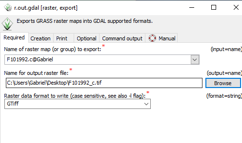
but, when I open the exported layer in ArcGIS the Range of values in modified…
Thanks a lot for your help.
Kid regards
Gabriel
Hi Gabriel,
I would be surprised if the data range is exported incorrectly (if you left autodetection of the data type to export to). Did you check the range of the data with:
gdalinfo -mm F101992_c.tif
?
Maybe it is just a display issue cause for example ArcGIS might just estimates the range…
See otherwise also examples here for compatibility:
https://grass.osgeo.org/grass76/manuals/r.out.gdal.html
Cheers
Stefan
(attachments)
···
Dear grass users,
I got after intercallibrarion the following layer (with a correct Range of data: min = -0.3458 max = 61.9423 ) whats is the recommended way to get it exported out of grass to be opened in ArcGIS, conserving the range.
When i do :
![image.png]()
but, when I open the exported layer in ArcGIS the Range of values in modified…
Thanks a lot for your help.
Kid regards
Gabriel
Dear Stefan,
Yes you are right ranges are correct.
Thanks a lot.
Gabriel
On Monday, September 9, 2019, Stefan Blumentrath <Stefan.Blumentrath@nina.no> wrote:
Hi Gabriel,
I would be surprised if the data range is exported incorrectly (if you left autodetection of the data type to export to). Did you check the range of the data with:
gdalinfo -mm F101992_c.tif
?
Maybe it is just a display issue cause for example ArcGIS might just estimates the range…
See otherwise also examples here for compatibility:
https://grass.osgeo.org/grass76/manuals/r.out.gdal.html
Cheers
Stefan
From: grass-user <grass-user-bounces@lists.osgeo.org> On Behalf Of Gabriel Cotlier
Sent: mandag 9. september 2019 07:44
To: grass-user <grass-user@lists.osgeo.org>; Markus Metz <markus.metz.giswork@gmail.com>; Nikos Alexandris <nik@nikosalexandris.net>; Veronica Andreo <veroandreo@gmail.com>
Subject: [GRASS-user] question exporting from grass GeoTif files
Dear grass users,
I got after intercallibrarion the following layer (with a correct Range of data: min = -0.3458 max = 61.9423 ) whats is the recommended way to get it exported out of grass to be opened in ArcGIS, conserving the range.
When i do :
but, when I open the exported layer in ArcGIS the Range of values in modified…
Thanks a lot for your help.
Kid regards
Gabriel