[GRASS-user] v.surf.idw Not Working

Hello,

I have recently been struggling with an issue in GRASS. I am a new GRASS user and recently downloaded version 7.8.5 for my MacBook (macOS Catalina). I converted this sample dataset to a shapefile. I am able to load and visualize the file and set the region to be the loaded set of points. When I run v.surf.idw, I get the following error:

v.surf.idw input=coal_test@PERMANENT output=coal_test_tested
Input vector map <coal_test@PERMANENT> is 2D - using categories to interpolate
WARNING: No record for point (cat = 1)
WARNING: No record for point (cat = 2)
WARNING: No record for point (cat = 3)
.
.
.
WARNING: No record for point (cat = 96)
0 points loaded
ERROR: No points found

I have tried to use v.surf.idw with different datasets as well and am still getting the same error. I’ve also tried re-installing GRASS GIS to no avail. I’d appreciate any help you can provide!

Thanks,
Michaela

Hi Michaela,

On Thu, Feb 11, 2021 at 11:47 PM Michaela Lobato <amlobat2@illinois.edu> wrote:

Hello,

I have recently been struggling with an issue in GRASS. I am a new GRASS user and recently downloaded version 7.8.5 for my MacBook (macOS Catalina). I converted this sample dataset to a shapefile.

Could you make this shapefile available? Or post the data structure?

# attribute table structure
v.info -c coal_test

# vector types
v.info -t coal_test

?

Best,
Markus

Hi Markus,

Here is the information:

v.info -c map=coal_test@PERMANENT
INTEGER>cat
INTEGER>cat_
INTEGER>int_1
INTEGER>int_2
DOUBLE PRECISION|dbl_1
DOUBLE PRECISION|dbl_2
DOUBLE PRECISION|dbl_3
DOUBLE PRECISION|dbl_4
DOUBLE PRECISION|dbl_5
Displaying column types/names for database connection of layer <1>:

v.info -t map=coal_test@PERMANENT
nodes=0
points=96
lines=0
boundaries=0
centroids=0
areas=0
islands=0
primitives=96
map3d=0

You can also find the file here https://github.com/amlobat2/Coal-Test-Shapefile. Let me know if you need any additional information.

Best,
Michaela

···

A. Michaela Lobato
BS Systems Engineering and Design | Autonomous Systems and Robotics | December 2019
MS Systems and Entrepreneurial Engineering | Decision and Control | In Progress
Email: amlobat2@illinois.edu | Cell: (815) 494-1111

I tried with your shapefile, and got no errors. Here are the steps…
First I created a new GRASS location matching the CRS of the shapefile:

grass -c Coal-Test-Shapefile-main/coal_test.shp /home/micha/GIS/grass/michaela

Check the projection:

g.proj -p
-PROJ_INFO-------------------------------------------------
name : RD/83 / 3-degree Gauss-Kruger zone 5
ellps : bessel
proj : tmerc
lat_0 : 0
lon_0 : 15
k : 1
x_0 : 5500000
y_0 : 0
no_defs : defined
-PROJ_EPSG-------------------------------------------------
epsg : 3399
-PROJ_UNITS------------------------------------------------
unit : meter
units : meters
meters : 1

Then I imported your shapefile, and set the computational region:

v.import Coal-Test-Shapefile-main/coal_test.shp output=coal_test
g.region -ap vect=coal_test # Resolution is 1 meter, 1500x1500 pixels

Now run the IDW module
v.surf.idw input=coal colu=dbl_1 out=coal_idw_1
81 points loaded
Interpolating raster map <coal_idw_1> (1500 rows, 1500 columns)…
100%
v.surf.idw complete.

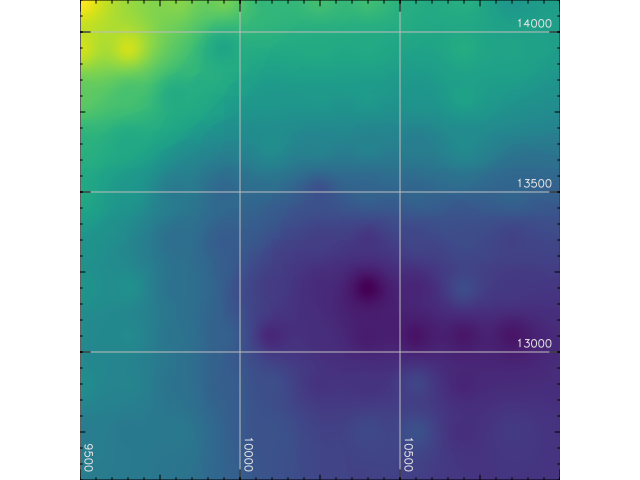
Resulting image is attached. You can try other options to v.surf.idw to get a smoother interpolation, if necessary.
HTH

(attachments)

coal_idw_1.png

···

Micha Silver
Ben Gurion Univ
Sde-Boker Remote Sensing Lab
cell: +972 (52) 3665918

Thank you for your message. I was able to get v.surf.idw working. I posted the original question because I am struggling to use the r.mblend add-on module. I have reached out and worked with the r.mblend authors on Github but still haven’t been able to solve my issue. The error I am getting has to do with v.surf.idw:

Traceback (most recent call last):
File “/Users/michaelalobato/Library/GRASS/7.8/Modules/scripts/r.mblend”, line 282, in .
main()
File “/Users/michaelalobato/Library/GRASS/7.8/Modules/scripts/r.mblend”, line 257, in main
gscript.run_command(‘v.surf.idw’, input=points_edges, column=COL_VALUE,
File “/Applications/GRASS-7.8.app/Contents/Resources/etc/python/grass/script/core.py”, line 441, in run_command
return handle_errors(returncode, returncode, args, kwargs)
File “/Applications/GRASS-7.8.app/Contents/Resources/etc/python/grass/script/core.py”, line 342, in handle_errors
raise CalledModuleError(module=None, code=code,
grass.exceptions.CalledModuleError: Module run None v.surf.idw input=tmp_3289117 column=value output=tmp_3289118
power=2 npoints=50 ended with error
Process ended with non-zero return code -9. See errors in the (error) output.
WARNING: No data base element files found
WARNING: Table <tmp_3289111> linked to vector map <tmp_3289111> does not exist

The author said that “The v.surf.idw module is failing because it can not find the attribute table of one the vector layers. This probably means something is going on with the GRASS bank-end database.” and requested the following information:

db.connect -p

driver: sqlite

database: /Users/michaelalobato/Documents/Research/grassdata/newChampaign/test_champaign/sqlite/sqlite.db

schema:

group:

sqlite3 /Users/michaelalobato/Documents/Research/grassdata/champaign/PERMANENT/sqlite/sqlite.db

sqlite> .tables

sqlite>

As you can see, when I try to list the existing tables, nothing comes up. After this issue, I started working with just v.surf.idw to see if it might be an issue with the module itself, but that seems to be working fine. Does anyone have any suggestions as to how to solve the v.surf.idw issue that I’m having within the mblend module?

Thanks!

Michaela

On Fri, Feb 12, 2021 at 2:06 PM Micha Silver <tsvibar@gmail.com> wrote:

I tried with your shapefile, and got no errors. Here are the steps…
First I created a new GRASS location matching the CRS of the shapefile:

grass -c Coal-Test-Shapefile-main/coal_test.shp /home/micha/GIS/grass/michaela

Check the projection:

g.proj -p
-PROJ_INFO-------------------------------------------------
name : RD/83 / 3-degree Gauss-Kruger zone 5
ellps : bessel
proj : tmerc
lat_0 : 0
lon_0 : 15
k : 1
x_0 : 5500000
y_0 : 0
no_defs : defined
-PROJ_EPSG-------------------------------------------------
epsg : 3399
-PROJ_UNITS------------------------------------------------
unit : meter
units : meters
meters : 1

Then I imported your shapefile, and set the computational region:

v.import Coal-Test-Shapefile-main/coal_test.shp output=coal_test
g.region -ap vect=coal_test # Resolution is 1 meter, 1500x1500 pixels

Now run the IDW module
v.surf.idw input=coal colu=dbl_1 out=coal_idw_1
81 points loaded
Interpolating raster map <coal_idw_1> (1500 rows, 1500 columns)…
100%
v.surf.idw complete.

Resulting image is attached. You can try other options to v.surf.idw to get a smoother interpolation, if necessary.
HTH

On Fri, Feb 12, 2021 at 8:35 PM Michaela Lobato <amlobat2@illinois.edu> wrote:

Hi Markus,

Here is the information:

v.info -c map=coal_test@PERMANENT
INTEGER|cat
INTEGER|cat_
INTEGER|int_1
INTEGER|int_2
DOUBLE PRECISION|dbl_1
DOUBLE PRECISION|dbl_2
DOUBLE PRECISION|dbl_3
DOUBLE PRECISION|dbl_4
DOUBLE PRECISION|dbl_5
Displaying column types/names for database connection of layer <1>:

v.info -t map=coal_test@PERMANENT
nodes=0
points=96
lines=0
boundaries=0
centroids=0
areas=0
islands=0
primitives=96
map3d=0

You can also find the file here https://github.com/amlobat2/Coal-Test-Shapefile. Let me know if you need any additional information.

Best,
Michaela

On Fri, Feb 12, 2021 at 3:29 AM Markus Neteler <neteler@osgeo.org> wrote:

Hi Michaela,

On Thu, Feb 11, 2021 at 11:47 PM Michaela Lobato <amlobat2@illinois.edu> wrote:

Hello,

I have recently been struggling with an issue in GRASS. I am a new GRASS user and recently downloaded version 7.8.5 for my MacBook (macOS Catalina). I converted this sample dataset to a shapefile.

Could you make this shapefile available? Or post the data structure?

attribute table structure

v.info -c coal_test

vector types

v.info -t coal_test

?

Best,
Markus

A. Michaela Lobato
BS Systems Engineering and Design | Autonomous Systems and Robotics | December 2019
MS Systems and Entrepreneurial Engineering | Decision and Control | In Progress
Email: amlobat2@illinois.edu | Cell: (815) 494-1111


grass-user mailing list
grass-user@lists.osgeo.org
https://lists.osgeo.org/mailman/listinfo/grass-user

Micha Silver
Ben Gurion Univ
Sde-Boker Remote Sensing Lab
cell: +972 (52) 3665918

A. Michaela Lobato
BS Systems Engineering and Design | Autonomous Systems and Robotics | December 2019
MS Systems and Entrepreneurial Engineering | Decision and Control | In Progress
Email: amlobat2@illinois.edu | Cell: (815) 494-1111

On 2/15/21 8:51 PM, Michaela Lobato wrote:

Thank you for your message. I was able to getv.surf.idw working. I posted the original question because I am struggling to use the r.mblend add-on module. I have reached out and worked with the r.mblend authors on Github but still haven't been able to solve my issue. The error I am getting has to do with v.surf.idw:

So you're trying to blend two overlapping rasters of different resolution? Can we see the output of r.info for both of the rasters?

Traceback (most recent call last):
File "/Users/michaelalobato/Library/GRASS/7.8/Modules/scripts/r.mblend", line 282, in <module>.
main()
File "/Users/michaelalobato/Library/GRASS/7.8/Modules/scripts/r.mblend", line 257, in main
gscript.run_command('v.surf.idw', input=points_edges, column=COL_VALUE,
File "/Applications/GRASS-7.8.app/Contents/Resources/etc/python/grass/script/core.py", line 441, in run_command
return handle_errors(returncode, returncode, args, kwargs)
File "/Applications/GRASS-7.8.app/Contents/Resources/etc/python/grass/script/core.py", line 342, in handle_errors
raise CalledModuleError(module=None, code=code,
grass.exceptions.CalledModuleError: Module run None v.surf.idw input=tmp_3289117 column=value output=tmp_3289118
power=2 npoints=50 ended with error
Process ended with non-zero return code -9. See errors in the (error) output.
WARNING: No data base element files found
WARNING: Table <tmp_3289111> linked to vector map <tmp_3289111> does not exist

The author said that "/The |v.surf.idw| module is failing because it can not find the attribute table of one the vector layers. This probably means something is going on with the GRASS bank-end database./" and requested the following information:

db.connect -p

>driver: sqlite

>database: /Users/michaelalobato/Documents/Research/grassdata/newChampaign/test_champaign/sqlite/sqlite.db

>schema:

>group:

sqlite3 /Users/michaelalobato/Documents/Research/grassdata/champaign/PERMANENT/sqlite/sqlite.db

sqlite> .tables

>sqlite>

As you can see, when I try to list the existing tables, nothing comes up. After this issue, I started working with just v.surf.idwto see if it

The sqlite database is empty since you probably have no vector layers in your mapset. That's not necessarily a problem.

might be an issue with the module itself, but that seems to be working fine. Does anyone have any suggestions as to how to solve the v.surf.idw issue that I'm having within the mblend module?

Thanks!

Michaela

--
A. Michaela Lobato
BS Systems Engineering and Design | Autonomous Systems and Robotics | December 2019
MS Systems and Entrepreneurial Engineering | Decision and Control | In Progress
Email: amlobat2@illinois.edu <mailto:amlobat2@illinois.edu> | Cell: (815) 494-1111

--
Micha Silver
Ben Gurion Univ.
Sde Boker, Remote Sensing Lab
cell: +972-523-665918

Here is the output for r.info for both maps:

< r.info map=USGS_one_meter_x39y445_IL_12_County_ChampaignCo_2008@PERMANENT

±---------------------------------------------------------------------------+

| Map: USGS_one_meter_x39y445_IL_12_ Date: Tue Feb 16 18:44:21 2021 |

| Mapset: PERMANENT Login of Creator: michaelalobato |

| Location: champaign |

| DataBase: /Users/michaelalobato/Documents/Research/grassdata |

| Title: USGS_one_meter_x39y445_IL_12_County_ChampaignCo_2008 |

| Timestamp: none |

|----------------------------------------------------------------------------|

| |

| Type of Map: raster Number of Categories: 0 |

| Data Type: FCELL |

| Rows: 9015 |

| Columns: 11748 |

| Total Cells: 105908220 |

| Projection: Latitude-Longitude |

| N: 40:11:40.173254N S: 40:06:11.010398N Res: 0:00:00.03651 |

| E: 88:10:23.5766W W: 88:17:32.519389W Res: 0:00:00.036512 |

| Range of data: min = 204.0563 max = 244.8284 |

| |

| Data Description: |

| generated by r.proj |

| |

| Comments: |

| r.proj --quiet location=“temp_import_location_4329” mapset="PERMANEN\ |

| T" input=“USGS_one_meter_x39y445_IL_12_County_ChampaignCo_2008” meth\ |

| od=“nearest” memory=300 resolution=1.0142500028210239e-05 |

| |

±---------------------------------------------------------------------------+

< r.info map=n40_w089_1arc_v3@PERMANENT

±---------------------------------------------------------------------------+

| Map: n40_w089_1arc_v3@PERMANENT Date: Tue Feb 16 18:42:24 2021 |

| Mapset: PERMANENT Login of Creator: michaelalobato |

| Location: champaign |

| DataBase: /Users/michaelalobato/Documents/Research/grassdata |

| Title: n40_w089_1arc_v3 |

| Timestamp: none |

|----------------------------------------------------------------------------|

| |

| Type of Map: raster Number of Categories: 0 |

| Data Type: CELL |

| Rows: 3601 |

| Columns: 3601 |

| Total Cells: 12967201 |

| Projection: Latitude-Longitude |

| N: 41:00:00.5N S: 39:59:59.5N Res: 0:00:01 |

| E: 87:59:59.5W W: 89:00:00.5W Res: 0:00:01 |

| Range of data: min = 163 max = 305 |

| |

| Data Description: |

| generated by r.in.gdal |

| |

| Comments: |

| r.in.gdal -e input="/Users/michaelalobato/Documents/Research/grassda\ |

| ta/n40_w089_1arc_v3.tif" output=“n40_w089_1arc_v3” memory=300 offset\ |

| =0 num_digits=0 |

| |

±---------------------------------------------------------------------------+

Michalea
No solution yet :-(, only more questions...

It looks to me that the plugin is intended to work when the lowres raster extends the highres raster only in one direction. In your case, the 1 degree SRTM tile you are using totally contains the USGS 1 meter region.

To test this I would try to clip out a section of the SRTM:

# Set the computation region to the highres raster, then extend only in one direction

g.region -p rast=USGS_one_meter_x39y445_IL_12_County_ChampaignCo_2008

g.region -p w=88:20:00W

# Now clip the SRTM to this new region

# But use the coarse resolution

g.region -p res=0:00:01

r.mapcalc "n40_w089_clip = n40_w089_1arc_v3"

# Now try r.mblend with this clipped SRTM

r.mblend high=USGS_one_meter_x39y445_IL_12_County_ChampaignCo_2008 low=n40_w089_clip out=blend

Please report back if this helps (or not...)

On 2/17/2021 2:52 AM, Michaela Lobato wrote:

Here is the output for r.info <http://r.info> for both maps:

< r.info <http://r.info> map=USGS_one_meter_x39y445_IL_12_County_ChampaignCo_2008@PERMANENT

+----------------------------------------------------------------------------+

| Map:USGS_one_meter_x39y445_IL_12_Date: Tue Feb 16 18:44:21 2021|

| Mapset: PERMANENTLogin of Creator: michaelalobato|

| Location: champaign|

| DataBase: /Users/michaelalobato/Documents/Research/grassdata |

| Title:USGS_one_meter_x39y445_IL_12_County_ChampaignCo_2008 |

| Timestamp: none|

|----------------------------------------------------------------------------|

||

| Type of Map:raster Number of Categories: 0 |

| Data Type:FCELL|

| Rows: 9015 |

| Columns:11748|

| Total Cells:105908220|

|Projection: Latitude-Longitude|

|N: 40:11:40.173254NS: 40:06:11.010398N Res: 0:00:00.03651 |

|E: 88:10:23.5766WW: 88:17:32.519389W Res: 0:00:00.036512|

| Range of data:min = 204.0563max = 244.8284 |

||

| Data Description:|

|generated by r.proj |

||

| Comments:|

|r.proj --quiet location="temp_import_location_4329" mapset="PERMANEN\ |

|T" input="USGS_one_meter_x39y445_IL_12_County_ChampaignCo_2008" meth\ |

|od="nearest" memory=300 resolution=1.0142500028210239e-05 |

||

+----------------------------------------------------------------------------+

< r.info <http://r.info> map=n40_w089_1arc_v3@PERMANENT

+----------------------------------------------------------------------------+

| Map:n40_w089_1arc_v3@PERMANENT Date: Tue Feb 16 18:42:24 2021|

| Mapset: PERMANENTLogin of Creator: michaelalobato|

| Location: champaign|

| DataBase: /Users/michaelalobato/Documents/Research/grassdata |

| Title:n40_w089_1arc_v3 |

| Timestamp: none|

|----------------------------------------------------------------------------|

||

| Type of Map:raster Number of Categories: 0 |

| Data Type:CELL |

| Rows: 3601 |

| Columns:3601 |

| Total Cells:12967201 |

|Projection: Latitude-Longitude|

|N: 41:00:00.5NS: 39:59:59.5N Res: 0:00:01 |

|E: 87:59:59.5WW: 89:00:00.5W Res: 0:00:01 |

| Range of data:min = 163max = 305 |

||

| Data Description:|

|generated by r.in.gdal|

||

| Comments:|

|r.in.gdal -e input="/Users/michaelalobato/Documents/Research/grassda\ |

|ta/n40_w089_1arc_v3.tif" output="n40_w089_1arc_v3" memory=300 offset\ |

|=0 num_digits=0 |

||

+----------------------------------------------------------------------------+

Michalea

--
Micha Silver
Remote Sensing Lab, Sde Boker
Ben Gurion University
cell: +972-523-665918

Thanks for all your continued help. I did the steps you recommended and was met with a different error this time:

ERROR: Database connection not defined for layer 1

Traceback (most recent call last):

File “/Users/michaelalobato/Library/GRASS/7.8/Modules/scripts/r.mblend”, line 282, in

main()

File “/Users/michaelalobato/Library/GRASS/7.8/Modules/scripts/r.mblend”, line 240, in main

gscript.run_command(‘v.db.dropcolumn’, map=weight_points_edge, layer=‘1’,

File “/Applications/GRASS-7.8.app/Contents/Resources/etc/python/grass/script/core.py”, line 441, in run_command

return handle_errors(returncode, returncode, args, kwargs)

File “/Applications/GRASS-7.8.app/Contents/Resources/etc/python/grass/script/core.py”, line 342, in handle_errors

raise CalledModuleError(module=None, code=code,

grass.exceptions.CalledModuleError: Module run None v.db.dropcolumn map=tmp_8758116 layer=1 columns=along ended with error

Process ended with non-zero return code 1. See errors in the (error) output.

WARNING: No data base element files found

WARNING: No data base element files found

WARNING: No data base element files found

WARNING: No data base element files found

WARNING: Table <tmp_8758111> linked to vector map <tmp_8758111> does not

exist

···

A. Michaela Lobato
BS Systems Engineering and Design | Autonomous Systems and Robotics | December 2019
MS Systems and Entrepreneurial Engineering | Decision and Control | In Progress
Email: amlobat2@illinois.edu | Cell: (815) 494-1111

Hello:

On 2/19/21 6:46 PM, Michaela Lobato wrote:

Thanks for all your continued help. I did the steps you recommended and was met with a different error this time:

ERROR: Database connection not defined for layer 1

Traceback (most recent call last):

File "/Users/michaelalobato/Library/GRASS/7.8/Modules/scripts/r.mblend", line 282, in <module>

main()

File "/Users/michaelalobato/Library/GRASS/7.8/Modules/scripts/r.mblend", line 240, in main

gscript.run_command('v.db.dropcolumn', map=weight_points_edge, layer='1',

File "/Applications/GRASS-7.8.app/Contents/Resources/etc/python/grass/script/core.py", line 441, in run_command

return handle_errors(returncode, returncode, args, kwargs)

File "/Applications/GRASS-7.8.app/Contents/Resources/etc/python/grass/script/core.py", line 342, in handle_errors

raise CalledModuleError(module=None, code=code,

grass.exceptions.CalledModuleError: Module run None v.db.dropcolumn map=tmp_8758116 layer=1 columns=along ended with error

Process ended with non-zero return code 1. See errors in the (error) output.

WARNING: No data base element files found

WARNING: No data base element files found

WARNING: No data base element files found

WARNING: No data base element files found

WARNING: Table <tmp_8758111> linked to vector map <tmp_8758111> does not

exist

I was finally able to duplicate your error. This happens, it seems, only when working in a longitude/latitude location. When I used two DEM rasters in a *projected* location, the interpolation to high-resolution in the area covered only by the lowres raster worked fine. (Also if the lowres raster extends in two directions).

However in a Long/lat location, with units of degrees, the addon fails. I looked thru the source code, and my guess is that there is something in the conversion from interpolation area to vector lines that is failing. I'll report to the maintainer.

In any case, would you want to try to transform your DEM rasters to a projected location and rerun the module?

One caveat: be aware that interpolating a full SRTM tile (approx 110km x 110km) to a resolution of 1 meter will create a huge raster (if my numbers are right, it would be about 50GB) and would take a very long time. So I'd suggest to try this out first in a much smaller area.

On Thu, Feb 18, 2021 at 7:02 AM Micha Silver <tsvibar@gmail.com <mailto:tsvibar@gmail.com>> wrote:

    No solution yet :-(, only more questions...

    It looks to me that the plugin is intended to work when the lowres
    raster extends the highres raster only in one direction. In your
    case,
    the 1 degree SRTM tile you are using totally contains the USGS 1
    meter
    region.

    To test this I would try to clip out a section of the SRTM:

    # Set the computation region to the highres raster, then extend
    only in
    one direction

    g.region -p rast=USGS_one_meter_x39y445_IL_12_County_ChampaignCo_2008

    g.region -p w=88:20:00W

    # Now clip the SRTM to this new region

    # But use the coarse resolution

    g.region -p res=0:00:01

    r.mapcalc "n40_w089_clip = n40_w089_1arc_v3"

    # Now try r.mblend with this clipped SRTM

    r.mblend high=USGS_one_meter_x39y445_IL_12_County_ChampaignCo_2008
    low=n40_w089_clip out=blend

    Please report back if this helps (or not...)

    On 2/17/2021 2:52 AM, Michaela Lobato wrote:
    > Here is the output for r.info <http://r.info>
    <https://urldefense.com/v3/__http://r.info__;!!DZ3fjg!s23wIXUNs2hY7ZIpBfhbowUyUKf0QNHMqg0IZeaaHL7V9Tw8y2aYLaAANBXlarcJh-k$
    <https://urldefense.com/v3/__http://r.info__;!!DZ3fjg!s23wIXUNs2hY7ZIpBfhbowUyUKf0QNHMqg0IZeaaHL7V9Tw8y2aYLaAANBXlarcJh-k$&gt;
    > for both maps:
    >
    > < r.info <http://r.info>
    <https://urldefense.com/v3/__http://r.info__;!!DZ3fjg!s23wIXUNs2hY7ZIpBfhbowUyUKf0QNHMqg0IZeaaHL7V9Tw8y2aYLaAANBXlarcJh-k$
    <https://urldefense.com/v3/__http://r.info__;!!DZ3fjg!s23wIXUNs2hY7ZIpBfhbowUyUKf0QNHMqg0IZeaaHL7V9Tw8y2aYLaAANBXlarcJh-k$&gt;
    >
    > map=USGS_one_meter_x39y445_IL_12_County_ChampaignCo_2008@PERMANENT
    >
    +----------------------------------------------------------------------------+
    >
    > | Map:USGS_one_meter_x39y445_IL_12_Date: Tue Feb 16 18:44:21 2021|
    >
    > | Mapset: PERMANENTLogin of Creator: michaelalobato|
    >
    > | Location: champaign|
    >
    > | DataBase: /Users/michaelalobato/Documents/Research/grassdata |
    >
    > | Title:USGS_one_meter_x39y445_IL_12_County_ChampaignCo_2008 |
    >
    > | Timestamp: none|
    >
    |----------------------------------------------------------------------------|
    >
    > ||
    >
    > | Type of Map:raster Number of Categories: 0 |
    >
    > | Data Type:FCELL|
    >
    > | Rows: 9015 |
    >
    > | Columns:11748|
    >
    > | Total Cells:105908220|
    >
    > |Projection: Latitude-Longitude|
    >
    > |N: 40:11:40.173254NS: 40:06:11.010398N Res: 0:00:00.03651 |
    >
    > |E: 88:10:23.5766WW: 88:17:32.519389W Res: 0:00:00.036512|
    >
    > | Range of data:min = 204.0563max = 244.8284 |
    >
    > ||
    >
    > | Data Description:|
    >
    > |generated by r.proj |
    >
    > ||
    >
    > | Comments:|
    >
    > |r.proj --quiet location="temp_import_location_4329"
    mapset="PERMANEN\ |
    >
    > |T" input="USGS_one_meter_x39y445_IL_12_County_ChampaignCo_2008"
    meth\ |
    >
    > |od="nearest" memory=300 resolution=1.0142500028210239e-05 |
    >
    > ||
    >
    +----------------------------------------------------------------------------+
    >
    > < r.info <http://r.info>
    <https://urldefense.com/v3/__http://r.info__;!!DZ3fjg!s23wIXUNs2hY7ZIpBfhbowUyUKf0QNHMqg0IZeaaHL7V9Tw8y2aYLaAANBXlarcJh-k$
    <https://urldefense.com/v3/__http://r.info__;!!DZ3fjg!s23wIXUNs2hY7ZIpBfhbowUyUKf0QNHMqg0IZeaaHL7V9Tw8y2aYLaAANBXlarcJh-k$&gt;
    > map=n40_w089_1arc_v3@PERMANENT
    >
    +----------------------------------------------------------------------------+
    >
    > | Map:n40_w089_1arc_v3@PERMANENT Date: Tue Feb 16 18:42:24 2021|
    >
    > | Mapset: PERMANENTLogin of Creator: michaelalobato|
    >
    > | Location: champaign|
    >
    > | DataBase: /Users/michaelalobato/Documents/Research/grassdata |
    >
    > | Title:n40_w089_1arc_v3 |
    >
    > | Timestamp: none|
    >
    |----------------------------------------------------------------------------|
    >
    > ||
    >
    > | Type of Map:raster Number of Categories: 0 |
    >
    > | Data Type:CELL |
    >
    > | Rows: 3601 |
    >
    > | Columns:3601 |
    >
    > | Total Cells:12967201 |
    >
    > |Projection: Latitude-Longitude|
    >
    > |N: 41:00:00.5NS: 39:59:59.5N Res: 0:00:01 |
    >
    > |E: 87:59:59.5WW: 89:00:00.5W Res: 0:00:01 |
    >
    > | Range of data:min = 163max = 305 |
    >
    > ||
    >
    > | Data Description:|
    >
    > |generated by r.in.gdal|
    >
    > ||
    >
    > | Comments:|
    >
    > |r.in.gdal -e
    input="/Users/michaelalobato/Documents/Research/grassda\ |
    >
    > |ta/n40_w089_1arc_v3.tif" output="n40_w089_1arc_v3" memory=300
    offset\ |
    >
    > |=0 num_digits=0 |
    >
    > ||
    >
    +----------------------------------------------------------------------------+
    >
    > Michalea
    >
    -- Micha Silver
    Remote Sensing Lab, Sde Boker
    Ben Gurion University
    cell: +972-523-665918

--
A. Michaela Lobato
BS Systems Engineering and Design | Autonomous Systems and Robotics | December 2019
MS Systems and Entrepreneurial Engineering | Decision and Control | In Progress
Email: amlobat2@illinois.edu <mailto:amlobat2@illinois.edu> | Cell: (815) 494-1111

--
Micha Silver
Ben Gurion Univ.
Sde Boker, Remote Sensing Lab
cell: +972-523-665918