Hi,
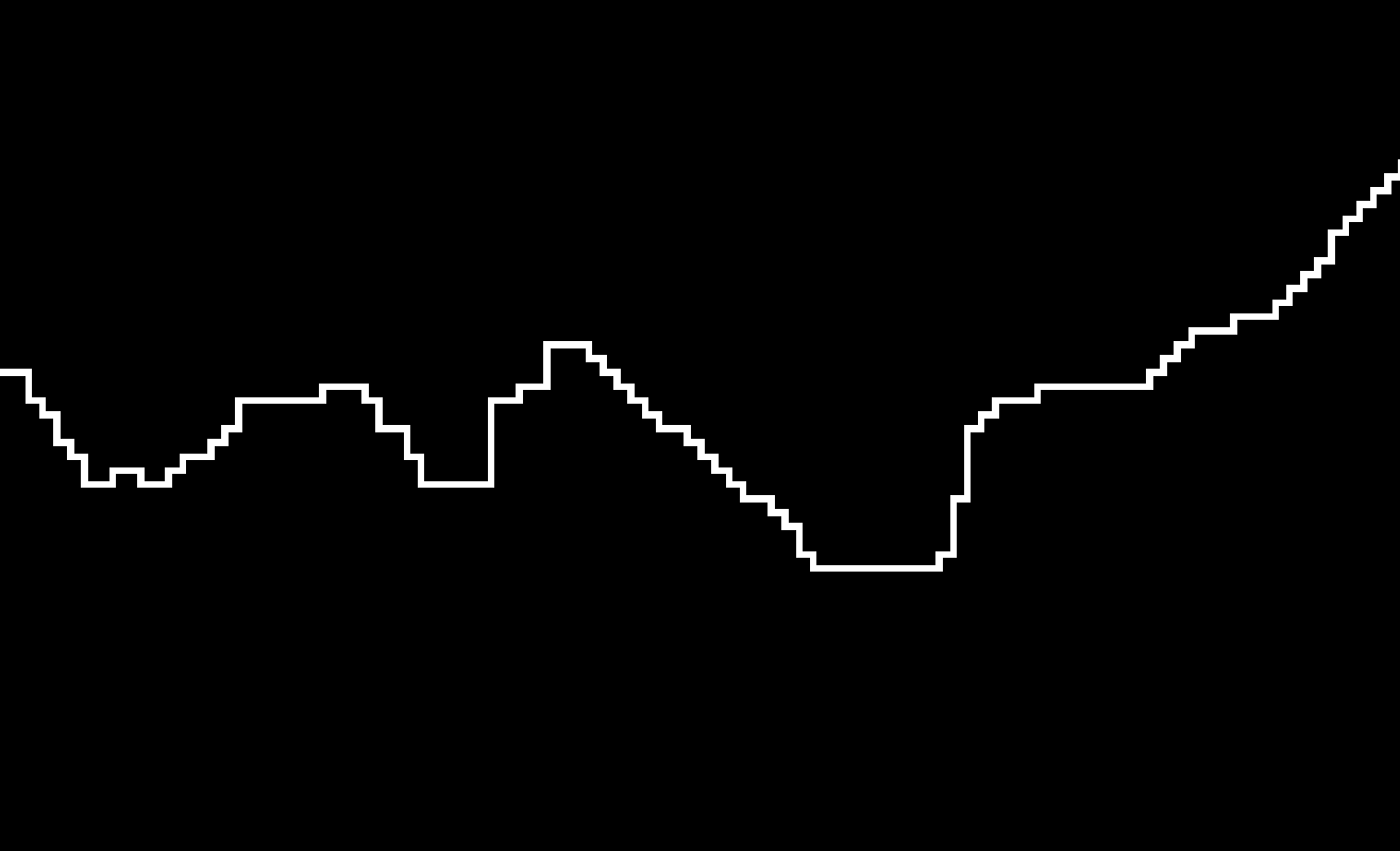
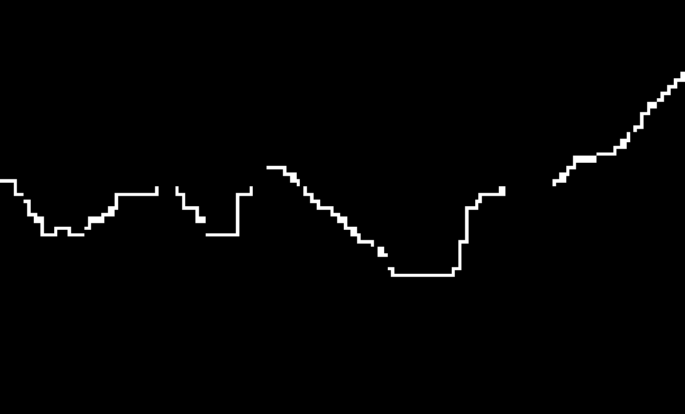
When converting from lines to raster using v.to.rast, the result is good when still a temporary file, but when i saved it, the lines are know disconnected:
Temporary file:
Saved geotif file:
How to solve?
OBS: v.to.raster: https://grass.osgeo.org/grass78/manuals/v.to.rast.html
···
Cumprimentos,
Valter Albino - Geógrafo Físico, M.Sc.
Modelação H&H / Riscos ambientais / OT&U
www.valteralbino.wixsite.com/hydrodynamics
Hi,
On Mon, Mar 16, 2020 at 4:37 PM Valter Albino <valteralbino@gmail.com> wrote:
Hi,
When converting from lines to raster using v.to.rast, the result is good when still a temporary file, but when i saved it, the lines are know disconnected:
… what are your steps in detail?
v.to.rast generates directly a raster map, which temporary file do you refer to?
And when you export this raster map to e.g. GeoTIFF with r.out.gdal, it is done at the resolution and extent of the computational region.
Pseudo-code
-
g.region … set to desired raster resolution and extent (bounding box)
-
v.to.rast …
-
r.out.gdal …
Best,
Markus
My fault => forgot to write that the process was done in GRASS GIS, from QGIS. The temporary file is loaded by default and then i save it (geotiff) in some location. Does it make sense?
I’am using QGIS 3.12.0 + GRASS 7.8.2
Valter Albino <valteralbino@gmail.com> escreveu no dia segunda, 16/03/2020 à(s) 15:57:
···
Cumprimentos,
Valter Albino - Geógrafo Físico, M.Sc.
Modelação H&H / Riscos ambientais / OT&U
www.valteralbino.wixsite.com/hydrodynamics