Hi
I have a problem trying to project the etopo2 model from a lat/long
location to a location with utm33 projection.
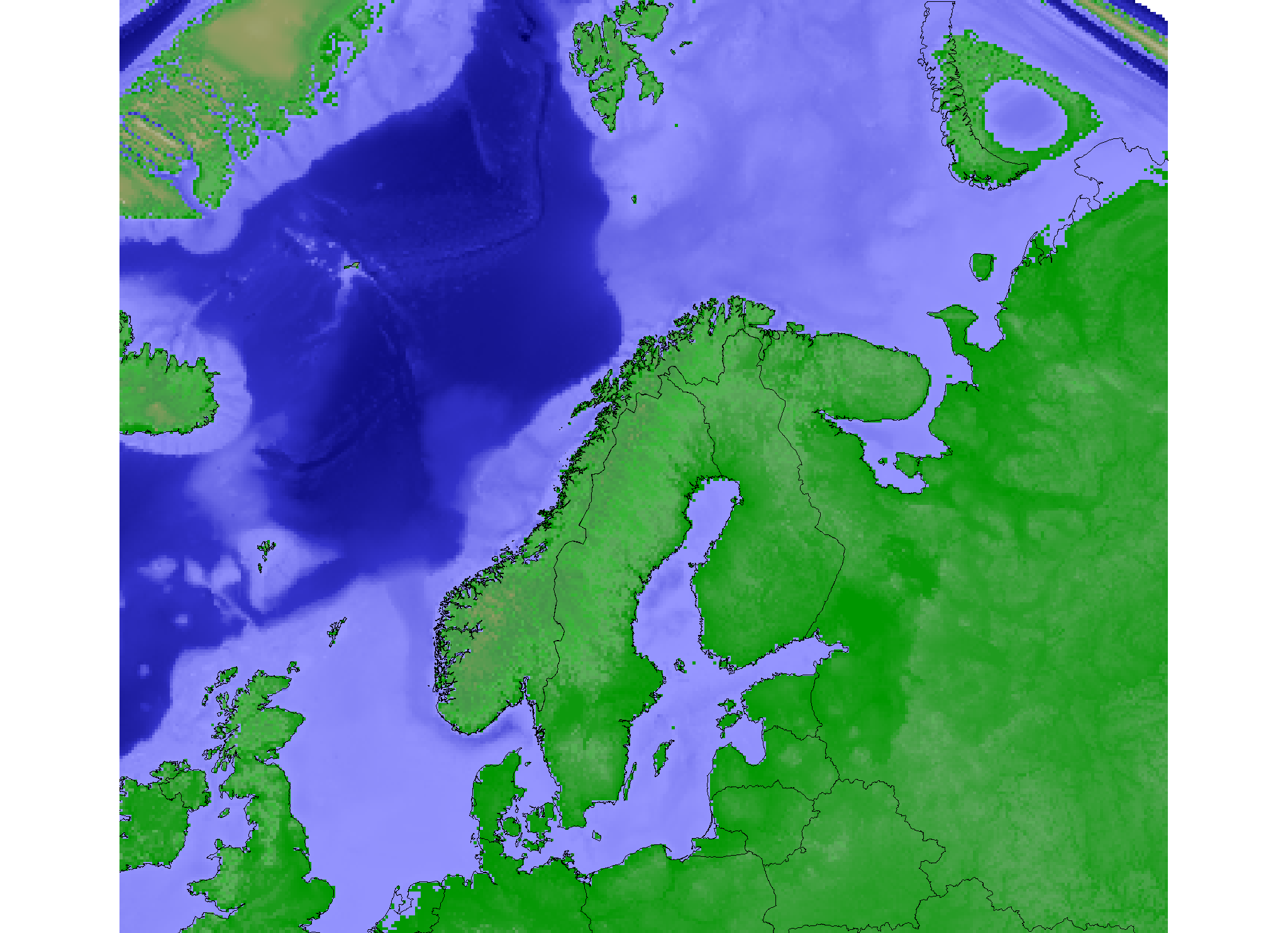
As the illustration shows, the etopo2-model is distorted compaired with
the vector map projected from the same location.
The lat/lon location has a wgs84 projection, and the etopomodel was
imported with r.in.bin as described in newsletter no. 1 and g.region
rast=etopo2 was used to fit the region to the rastermap. The vectormap
was imported to the same location with v.in.ogr, and the fit between the
etopo2-raster and the vector is good. The utm33 location was also
created with a wgs datum/projection but with raster resolution of 10000
meters, and the maps where projected with
r.proj input=etopo2 location=latlong mapset=PERMANENT output=etopo2
method=nearest and
v.proj input=world location=latlong mapset=PERMANENT output=world
So, my question is; what is happening in the projection prosess of the
etopo-raster that is not happening to the vector?
It's obvious that there will be some distortion the further east/west
from the utm33 zone we move, but why is the raster much more distorted
than the vector?
Thanks in advance!
Knut Langeland
ph-d student
Norwegian Institute for Nature Research -NINA
-division of arctic ecology
<mailto:d@nina.no>
(attachments)
Knut,
Did you try interpolation rather than just nearest neighbour re-sampling? Maybe method=bilinear rather than method=nearest. I don't think it looks all that bad. Bear in mind that what appears to be the land/sea border depends on the colour table you have chosen. E.g. much of the Netherlands appears sea-coloured because it is actually below sea level.
On Sat, 12 Mar 2005 knut.langeland@nina.no wrote:
So, my question is; what is happening in the projection prosess of the
etopo-raster that is not happening to the vector?
It's obvious that there will be some distortion the further east/west
from the utm33 zone we move, but why is the raster much more distorted
than the vector?
Possibly because they aren't the same data? (or are they; you didn't say where you got the vector map from).
I would recommend to read the r.proj man page if you haven't done so already. Sorry can't be more helpful but just thought I'd comment.
Paul
knut.langeland@nina.no wrote:
So, my question is; what is happening in the projection prosess of the
etopo-raster that is not happening to the vector?
Rasters are projected using the inverse projection function, while
vectors use the forward projection function. If one is not the exact
inverse of the other, then the two may not align exactly.
Looking at the PROJ source code for the transverse mercator projection
(PJ_tmerc.c), I see that the equations used for the ellipsoid case
include cubic polynomials. As the inverse transformation doesn't
calculate any cube roots, it can't be an exact inverse of the forward
calculation, only an approximation. The approximation may only be good
for the typical range of the projection (i.e. within 3 degrees of the
central meridian for UTM).
If you want to project a raster map using the forward projection, you
have to convert it to a site map (r.to.sites), project the site map
(s.proj), then convert the projected site map back to a raster map
(s.surf.rst). The preceding sentence assumes 5.0/5.4; the sites
functionality has been subsumed into the new vector functionality in
5.7/6.0.
--
Glynn Clements <glynn@gclements.plus.com>