I can not stress enough how awesome this release is - especially map rendering speed has become so fast.
I have a project with ~750 layers (650 of them rasters images for urban development planning) - most of them are not “switched on” at map load. It used to take 50sec ± to load the project in the browser window. this has become ~2sec (with py-qgis-server + preload_config set).
All those other improvements are nice as well (child layer table for example is also super cool!)
Into the [projects.cache] block of the /srv/qgis/server.conf file
In the txt file I have the absolute path to the .qgs files which should be preloaded - then restart your server and you are done (this is not a layer based pre-seeding - this simply loads the project into the servers memory and has it ready to be served. I never used layer based seeding)
Are any of the test/demo lizmap sites running 3.9x yet? (I want to try a couple of things- geopdf printing in easting/northing flipped CRS’, wfs 2.0 connections)
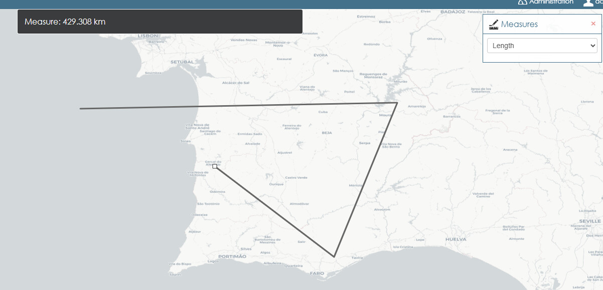
I’m using now 3.9.0 and trying new features and proof of concept…one of my colleagues asked me if I could include on this toolbar the possibility to change between kilometers, miles and nautical miles
@carekapt Maybe better to create a dedicated topic on discourse, otherwise this topic about 3.9.0 release announcement will be a mix of subjects…
I didn’t understand in your request if you got any JS skills and if you succeeded with that. If so, feel free to provide a pull request on GitHub, contributions are welcome. Of course, overwriting core code is a temporary fix, as you need to patch your own version of Lizmap at every release, but it works … to make a POC.
Maybe there is an typing mistake in your topic:
It should be added:
preload_config = /srv/qgis/config/preload_projects.txt
and not
Preload_config = /srv/qgis/config/preload_projects.txt
@Cbastianig since 3.9 version all inline commands provided by external .js are disabled by design because of DOM security needs. So all the scripts containing any inline command stops to work.
For me it is still working. Consider opening a own topic here so we can together try to troubleshoot your problem. Or, if you think it is a bug, create a ticket on github.