Users repeatedly ask about the possibility of selecting existing points (boundary points, building points, …) when measuring. Similar to snapping when digitizing new elements.
Couldn’t that be interesting for many people?
Or is there a solution that I don’t know yet?
If necessary, I would contribute financially to a corresponding addition. Are there any other supporters?
I think we will merge measuring and draw tools in Lizmap 3.9. Current measuring tool is based on OpenLayers 2, drawing tool is based on OpenLayers 10.
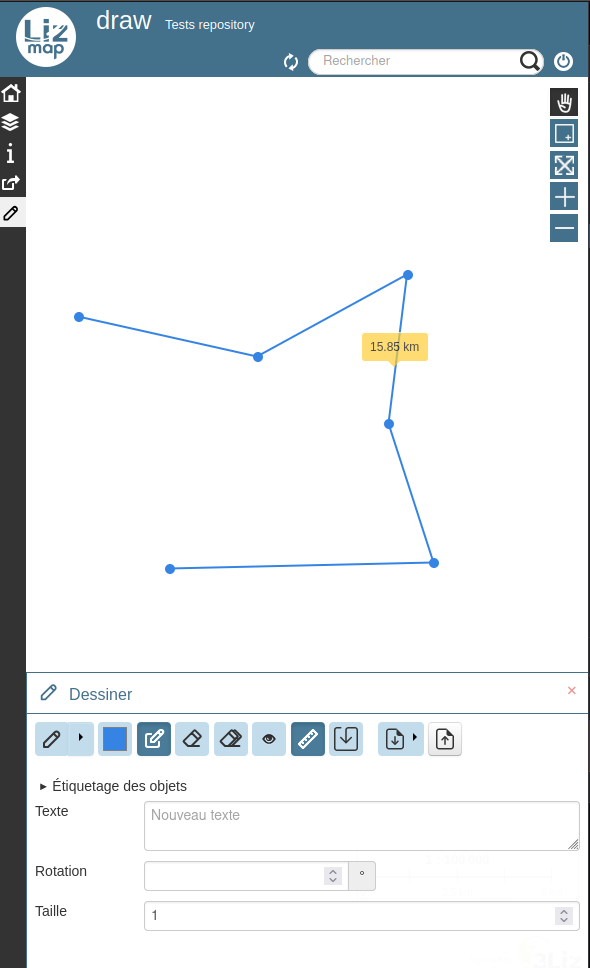
So I advise you to use the drawing tool with the measure and edition buttons activated. You’ll get the measure for the whole geometry but not for every parts though.
Please test it and report us the limitations, we’ll tell you the cost of developments.
1 Like
Thank you for the hint about measuring while drawing. I hadn’t discovered that yet.
The only thing missing now is snapping to existing points.
Personally, I would not combine simple normal measuring and measuring while drawing (with snapping). Simple measuring is enough for the normal user. Many people are already overwhelmed with the drawing menu.
And snapping the points can also give the illusion of false accuracy. This is because you also need to know or be able to judge the accuracy of the selected points.
Two suggestions for the drawing function:
- It would be nice if you could delete the last position with the backspace key when drawing.
- And the labeling should be included in the printout (see below).
I have solved the requirement for measuring incl. snapping via the digtialization option with PG data (incl. automatic labeling of lines and areas) but this is quite cumbersome in practice.
I am still discussing the drawing and measuring with users and will give feedback again at the end of the week.
Screenshot:
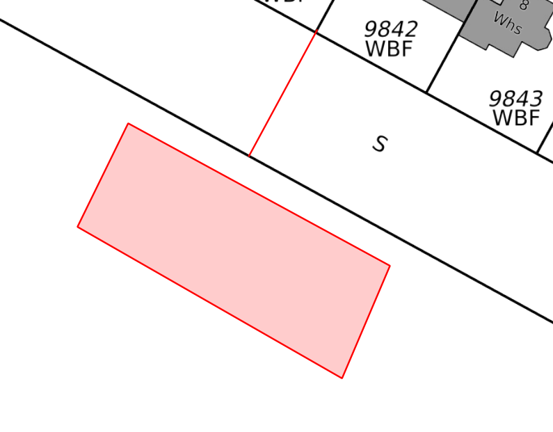
Print:
After consultation with the users of a city administration, the above suggestions were confirmed. In particular, the possibility of printing the measurement results is desired (see above)
The simple measurement method should be retained if possible (for normal users without GIS knowledge / citizens)
The realization of the measurement function with snapping via data in the PG-DB works perfectly and is well accepted by the users.
1 Like