For the same file, I am getting point location placement discrepancies between image/PNG and image/JPEG. Is this a known problem? Are there fix(es)?
It is not a known problem to me, what is a “point location placement discrepancies” ?
GeoServer 1) draws and image, and then 2) Encoding the image (in jpeg or png)
The only thing I could think of is if you are directly accessing a raster, then it does a fast-path, avoiding the “draw step”, directly read the contents out of the raster, into the jpeg or png encoding.
Please be more specific or provide link to your output so we caa see what you mean.
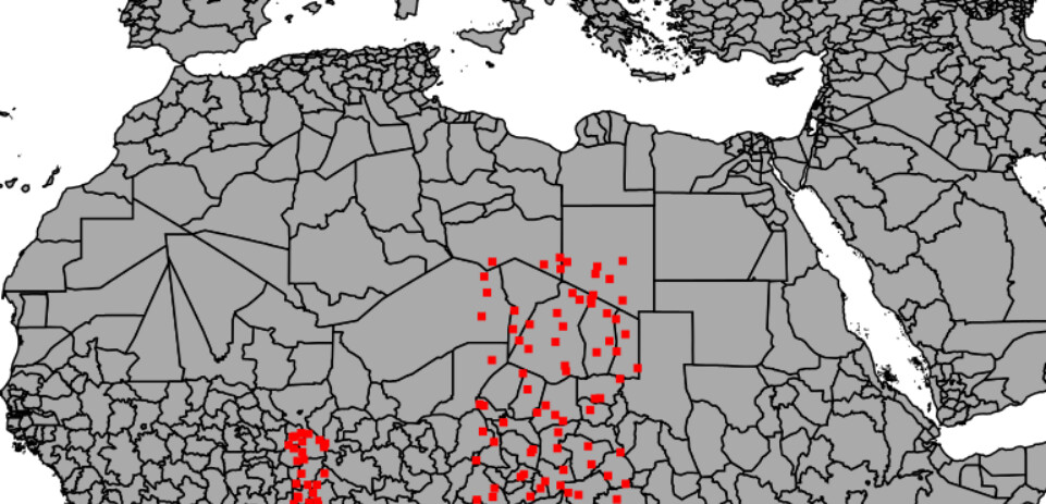
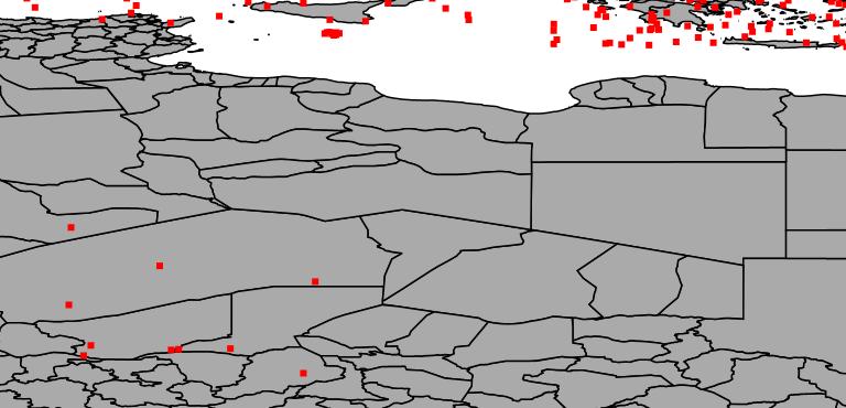
The top image is a png using OpenLayers and the bottom image is a WMS JPEG. The images were made with the same data points so it was expected that the red squares would be in the same place in both images.
Wow that is quite the change, as the projection has changed I expect much more than the image format is different between the two requsts - do you have the GetMap URLs submitted?
If you are using the new openlayers preivew there is test button that allows you to copy the URL used when making requests.
So that is
service=WMS&
version=1.1.0&
request=GetMap&
layers=mrs:AdminSubdivisionSurface_VW_500m,mrs:unit&
bbox=6.568,9.388,26.406,38.328&
width=768&
height=370&
srs=EPSG:4326&
styles=&
format=image/png&
KeyId=694a05e5-21de-4e28-922a-5d85f2f79723
That looks a normal box range with EPSG.4326. So my next question is how you have the layer of dots (I assume mrs:unit) configured? What is its SRS and SRS Handling?
You should also be able to look at what request OpenLayers is making, to determine what parameter is being used to get the correct visual on screen.
Does GeoServer define a minimum, maximum, or default number of records to be retrieved from Elasticsearch?